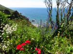
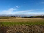
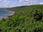
The Rame Peninsula is often known locally as "The
Forgotten Corner". It is bounded by water on 3 sides: the rivers
Lynher and Tamar and by Plymouth Sound. It is the south eastern-most
part of South East Cornwall lying just across the border with Devon
and the City of Plymouth. The name Rame means "The high protruding
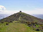
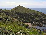
cliff, the ram's head" and Rame Head can be seen from many miles
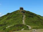
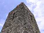
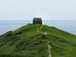
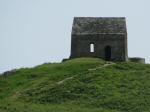
and has been a landmark for sailors for thousands of years. Right at
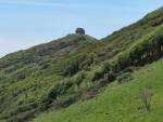
the top of Rame Head, some 320 feet above sea level, lies the ruined
chapel of St. Michael. The chapel, which was licensed for Mass in 1397,
is believed to stand on the site of a much older Celtic hermitage. From
1486 Plymouth paid a watchman to maintain a beacon here to warn sailors
and to inform the city of approaching important ships. The return of
the Newfoundland fishing fleet used to be signaled from here during
the 16th century and in 1588 the Spanish Armada was also sighted sailing
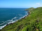
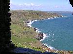
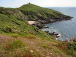
up the channel. Today a coastguard station is still positioned on Rame
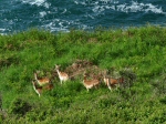
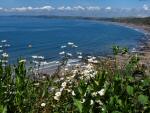
head and the views of the approaches to Plymouth Sound, Wembury Bay,
Great Mewstone Island, Polhawn Cove and the sandy beaches of Whitsand
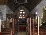
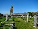
Bay remain as stunning as ever. Nearby lies Rame Church first consecrated
in 1259 and dedicated to St Germanus.
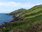
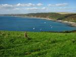
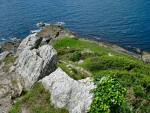
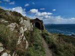
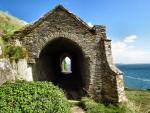
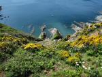
To the southeast of Rame Head there is another coastal headland lying
at the entrance to Plymouth Sound; this is Penlee Point (Cornish: Penn
Legh, meaning stone-slab headland). At Penlee Point you can see a ittle
grotto known as Queen Adelaide's Seat. In the eighteenth century, the
cave that today contains the grotto was used as a watch house. The stone
archways were constructed within its walls and dedicated to Princess
Adelaide after she visited in 1827, four years later she was crowned
Queen Consort having been married to King William IV. Also at Penlee
Point there is an Atmospheric Observatory established by the Plymouth
Marine Laboratory in May 2014 for long term observations of ocean-atmosphere
interaction.
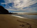
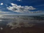
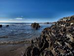
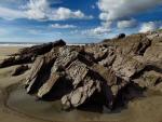
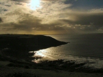
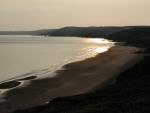
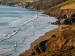
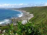
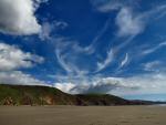
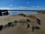
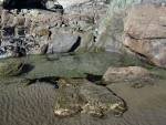
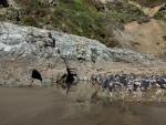
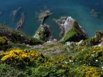
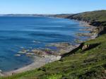
Whitsand Bay lies south-west of Plymouth Sound with Rame Head forming
its eastern boundary and the small village of Portwrinkle to its west.
Polhwan cove is in the east of the bay, then long stetches of sandy
beaches run to the west interspersed with rocky headlands and small
bays, over Sharrow Point through Freathy beach to the wide expanse of
Tregantle beach. Fort Tregantle overlooks Tregantle beach, still occupied
by the Ministry of Defence, and Tregantle beach itself is closed when
the firing ranges at the fort are in operation. The holiday settlement
of Freathy, a collection of chalets, huts and shacks forms an haphazard
settlement stretching along and down the cliffs, quite an eyesore to
an otherwise dramatic view. The bay is popular with scuba divers because
of its marine life and in 2004, HMS Scylla, the former Royal Navy frigate
was scuppered nearby an existing World War II wreck, the Liberty Ship
James Eagan Layne, to provide a new underwater reef for divers. The
James Eagan Layne was built in 1944 in the United States of America.
After only three month's war service, on 21 March 1945, she was torpedoed
and sunk in Whitsand Bay by U-1195 whilst on a voyage from Barry, in
Wales bound for Ghent in Belgium. Thankfully there were no casualties
and the wreck has become of the most popular diving sites in the country.
|